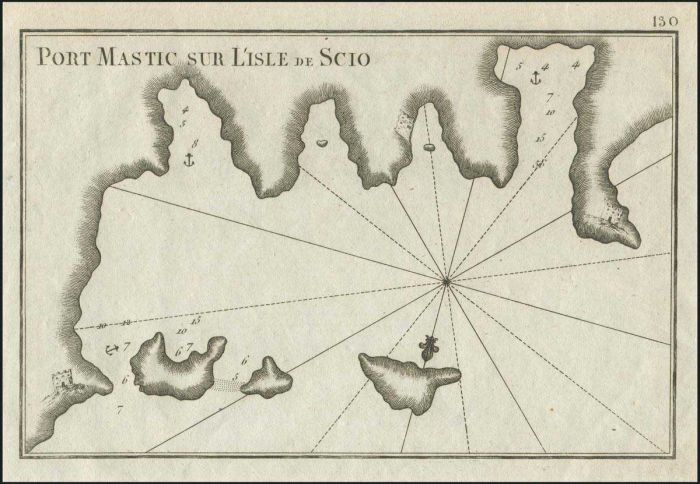
"Port MASTIC sur l'Isle de SCIO" J. Roux, 1764 from "Receuil des principaux plans des Ports et Rades..." by J.J. Allezard, Pl.130. Copper engraved map of LIMENAS port area on the SW coast of CHIOS. Fine. Zach.3054
Auction #470 - Maps & Engravings, Books, Photographs, Bonds
By: A. Karamitsos
A. Karamitsos Auction #470 - Maps & Engravings, Books, Photographs, Bonds
A. KARAMITSOS is holding an auction of Maps & Engravings, Books, Photographs and Bonds with 690 spectacular items, including:
Maps & Engravings
PAPER MONEY - BANKNOTES
Photograpgs
Bonds & Certificates
Books
Newspaperts & Magazines
Engravings
Ephemera
Documents
Refine Your Search
Filter By
Category
- various countries - archive photographs (171) Apply various countries - archive photographs filter
- various countries - bonds and certificates (43) Apply various countries - bonds and certificates filter
- various countries - books (16) Apply various countries - books filter
- various countries - documents (4) Apply various countries - documents filter
- various countries - engravings (199) Apply various countries - engravings filter
- various countries - ephemera (6) Apply various countries - ephemera filter
- various countries - maps (221) Apply various countries - maps filter
- various countries - newspapers - magazines (30) Apply various countries - newspapers - magazines filter
- Various countries - paper money - banknotes (1) Apply Various countries - paper money - banknotes filter
Lot #8152 - various countries - maps
"Pt. Du Petes" & "Pt. Boudron" J. Roux, 1764 from "Receuil des principaux plans des Ports et Rades..." by J.J. Allezard, Pl.134. Copper engraved map of BODRUM & area Turkey. Traces of light crease. Zach.3004
Lot #8153 - various countries - maps
"Rade de PAYOCASTRO au Rme. de CANDIE" J. Roux, 1764 from "Receuil des principaux plans des Ports et Rades..." by J.J. Allezard, Pl.138. Copper engraved map of PALEKASTRO area East CRETE. Traces of light crease. Zach.3058
Lot #8154 - various countries - maps
"MARMARA au N.E. de RHODE" J. Roux, 1764 from "Receuil des principaux plans des Ports et Rades..." by J.J. Allezard, Pl.139. Copper engraved map of MARMARIS South Turkey. Fine.
Lot #8155 - various countries - maps
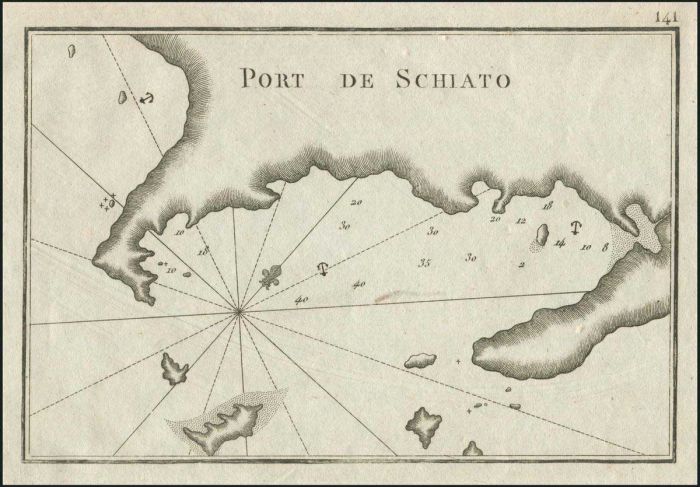
"Port De SCHIATO" J. Roux, 1764 from "Receuil des principaux plans des Ports et Rades..." by J.J. Allezard, Pl.141. Copper engraved map of port of SKIATHOS. Fine. Zach.3060
Lot #8156 - various countries - maps
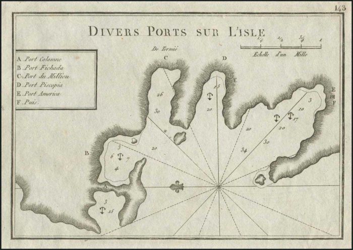
"Divers Ports sur L'Isle" J. Roux, 1764 from "Receuil des principaux plans des Ports et Rades..." by J.J. Allezard, Pl.143. Copper engraved map prob. of TILOS island Dodecanese. Fine. Zach.3062
Lot #8157 - various countries - maps
"ISLE NACRY" J. Roux, 1764 from "Receuil des principaux plans des Ports et Rades..." by J.J. Allezard, Pl.144. Copper engraved map. Fine. Zach.3063
Lot #8158 - various countries - maps
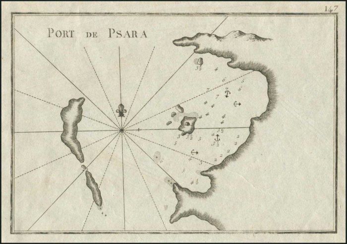
"Port de PSARA" J. Roux, 1764 from "Receuil des principaux plans des Ports et Rades..." by J.J. Allezard, Pl.147. Copper engraved map of Psara & port north of the current island port. Fine. Zach.3066
Lot #8159 - various countries - maps
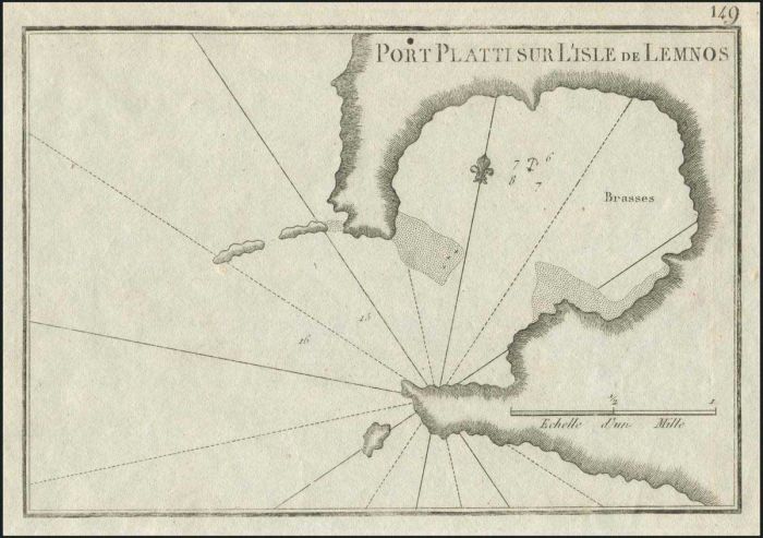
"Port PLATTI sur L'Isle de LEMNOS" J. Roux, 1764 from "Receuil des principaux plans des Ports et Rades..." by J.J. Allezard, Pl.149. Copper engraved map of LEMNOS island and small bay of PLATY. Fine. Zach.3067
Lot #8160 - various countries - maps
"Golfe de SAROS" J. Roux, 1764 from "Receuil des principaux plans des Ports et Rades..." by J.J. Allezard, Pl.151. Copper engraved map of Gulf of SAROS, Turkey. Fine.
Lot #8161 - various countries - maps
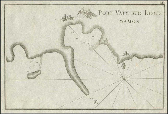
"Port VATY sur L'Isle SAMOS" J. Roux, 1764 from "Receuil des principaux plans des Ports et Rades..." by J.J. Allezard, Pl.153. Copper engraved map of Vathy at SAMOS island. Fine.. Zach.3069
Lot #8162 - various countries - maps
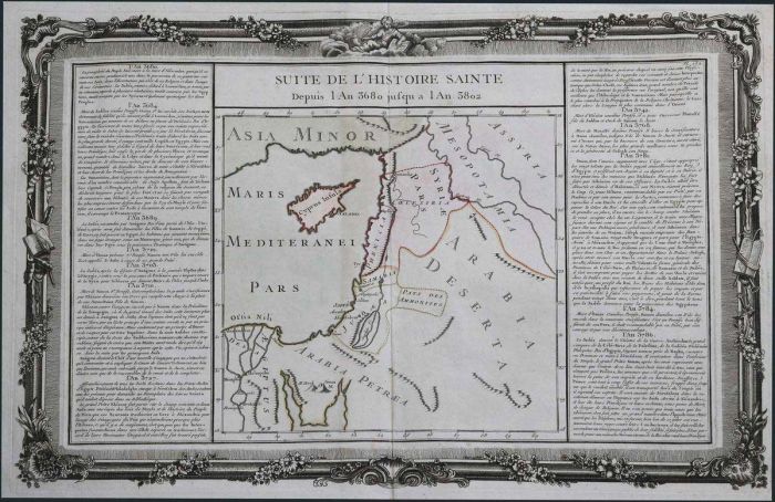
BRION DE LA TOUR "Suite de l'Histoire Sainte Depuis l An 3680 jusqu a l An 3802" from Nouvel itineraire general..." Paris c.1766. Hand coloure copper plate mapof Cyprus, Holy Land & Sinai with two strips of historical text. Dim.53x46cm. chipped margin edg
Lot #8163 - various countries - maps
"A MAP of EPIRUS, THESSALY, AND ACHAIA." copper engraved map by Hooke N. from "THE ROMAN HISTORY FROM THE Building of Rome to the Ruin of the Commonwealth" Vol.V Plate VII, printed by James Bettenham, London 1766. Illustrating ancient provincies, major to
Lot #8164 - various countries - maps
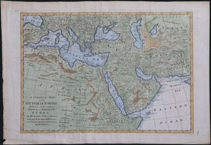
"A Correct Map of the OTTOMAN EMPIRE..." BOWEN T. 1777. A finely engraved & beautifully coloured copper plate map, extending from Spain to Tartary and from Balkans to Saudi Arabia. Roads & caravan routs, water sources in deserts and detailed place names.
Lot #8165 - various countries - maps
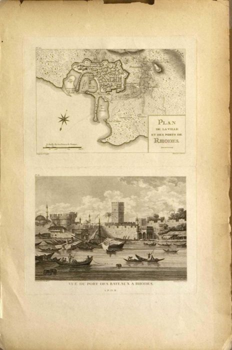
A page from the first edition of the famous book "M[arie] G[abriel] F[lorent] A[uguste] Comte de Choiseul-Gouffier: Voyage Pittoresque de la Grece, c.1, Paris, 1782" with the plates 60: "Plan de la ville et de ports de Rhodes / Redige par F. Kauffer & Gra
Lot #8166 - various countries - maps
A page from the first edition of the famous book "M[arie] G[abriel] F[lorent] A[uguste] Comte de Choiseul-Gouffier: Voyage Pittoresque de la Grece, c.1, Paris, 1782" with the plates 60: "Plan de la ville et de ports de Rhodes / Redige par F. Kauffer & Gra
Lot #8167 - various countries - maps
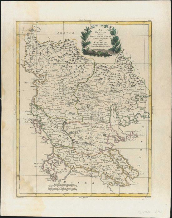
ZATTA A. "La Grecia divisa Nelle Sue Provincie Di nuova Projezione" 1782 from "Atlante novissimo" Drawn by Pitteri G., Engr. Zuliani G. Original outline colour, with coloured title cartouche to upper edge. Double page map showing northern Greece, Macedoni
Lot #8168 - various countries - maps
A page from the first edition of the famous book "M[arie] G[abriel] F[lorent] A[uguste] Comte de Choiseul-Gouffier: Voyage Pittoresque de la Grece, c.1, Paris, 1782" with the plates 96: "Plan du port et de la ville de Boudroun / Leve sur les Lieux par F.
Lot #8169 - various countries - maps
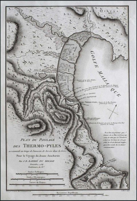
"PLAN DU PASSAGE DES THERMO-PYLES accomode au temps de l'invasion de Xerxes dans la Grece Pour le Voyage du Jeune Anacharsis Par J.D.BARBIE DU BOCAGE. Mai 1786 Vendemiaire An VIe/Grave par P.F.Tardieu Place de l'Estrapade No 18/L.Aubert scupist" edition "
Lot #8170 - various countries - maps
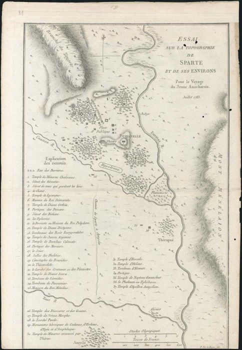
"ESSAI SUR LA TOPOGRAPHIE DE SPARTE Pour le Voyage du Jeune Anacharsis. Juillet 1783/P. De La Haye fils" coper plate map by Barbie du Bocage from J.J.Barthelemy's "Receuil de cartes et plans..." 1788-1791,1795. Depicting the environs of ancient Sparta, wi
Lot #8171 - various countries - maps
"PLAN DU PASSAGE DES THERMO-PYLES accommode au temps de l'invasion de Xerxes dans la Grece. Pour le Voyage du Jeune Anacharsis, Par M.BARBIE DU BOCAGE. Novembre 1784/Guill De La Haye" copper plate map by Barbie du Bocage from Barthelemy's "Receuil de cart
Lot #8172 - various countries - maps
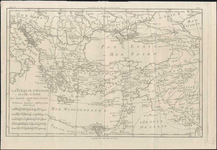
"LA TURQUIE D'EUROPE et celle d'Asie hors la partie situee dans l'Arabie. Par M.Bonne, Ingenieur-Hydrographe de la Marine" 1787 copper engraved map by R.Bonne from "Atlas encyclopedique contenant...", Paris. Depicting Greece, Italy, the BalkansTurkey, Pal
Lot #8173 - various countries - maps
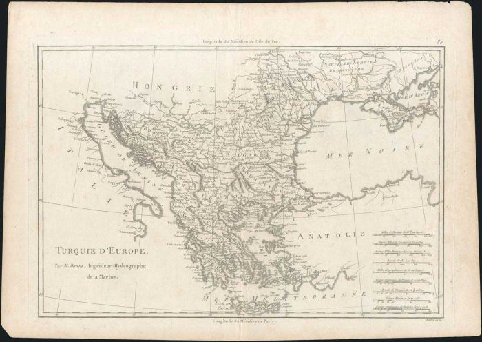
"TURQUIE D'EUROPE. Par M.Bonne, Ingenieur Hydrographe de la Marine", 1787 copper engraved map by R.Bonne from "Atlas encyclopedique contenant la geographie...", Paris. Engr. Dim.: 35x24cm. Depicting southeast Europe with Greece in centre of map and scale
Lot #8174 - various countries - maps
"Turquie D'Asie Al' Exception Des Enclaves Situees en Arabie" BONNE R. 1787, uncoloured copper plate map extending from Aegean to Iraq, including Turkey, Cyprus, Syria, Palestine, Israel, Armenia, Jordan Azerbaycan. Map dim. 35x24cm. Chipped margin edges,
Lot #8175 - various countries - maps
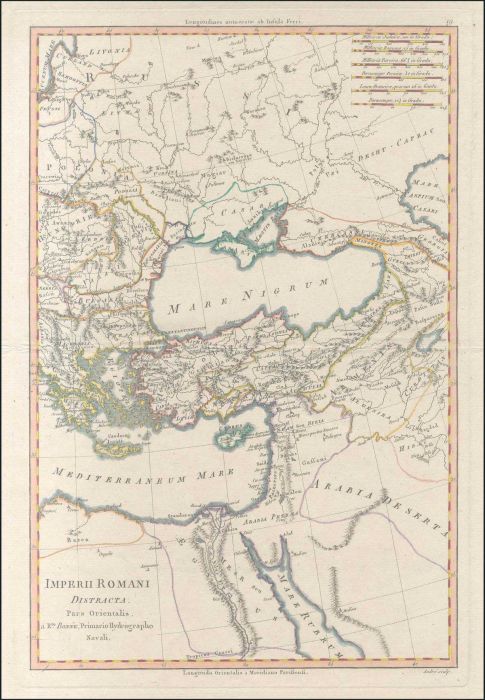
"Imperii Romani Distracta. Pars Orientalis" colour copper engr. map by R. Bonne at 1787. Shows eastern part of Roman Empire with Black Sea at the centre of the cartographic frame. Cyprus also represented. Slightly chipped margin edges. Very Fine. Map. dim
A. Karamitsos
A. Karamitsos are experienced auctioneers of Philatelic, Numismatic and Post Card. We are specialists in the stamps and postal history of Greece, Greek Errors, New Greek Territories, Levant,... Read More
Send Email to A. Karamitsos Or Visit WebSite


