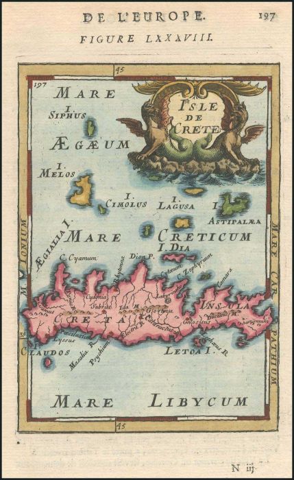
"Isle de CRETE". Full colour copper plate by MALLET, Allain Manesson, publ. in Paris 1683 in "Description de l'Univers". Attractive prospect of Crete & northern adjacent islands. Very Fine. Map dim. 11x14cm. Zach.2151.
Auction #470 - Maps & Engravings, Books, Photographs, Bonds
By: A. Karamitsos
A. Karamitsos Auction #470 - Maps & Engravings, Books, Photographs, Bonds
A. KARAMITSOS is holding an auction of Maps & Engravings, Books, Photographs and Bonds with 690 spectacular items, including:
Maps & Engravings
PAPER MONEY - BANKNOTES
Photograpgs
Bonds & Certificates
Books
Newspaperts & Magazines
Engravings
Ephemera
Documents
Refine Your Search
Filter By
Category
- various countries - archive photographs (171) Apply various countries - archive photographs filter
- various countries - bonds and certificates (43) Apply various countries - bonds and certificates filter
- various countries - books (16) Apply various countries - books filter
- various countries - documents (4) Apply various countries - documents filter
- various countries - engravings (199) Apply various countries - engravings filter
- various countries - ephemera (6) Apply various countries - ephemera filter
- various countries - maps (221) Apply various countries - maps filter
- various countries - newspapers - magazines (30) Apply various countries - newspapers - magazines filter
- Various countries - paper money - banknotes (1) Apply Various countries - paper money - banknotes filter
Lot #8052 - various countries - maps
"Is. de SIO et de PSARA". Full colour copper plate by MALLET, Allain Manesson, publ. in Paris 1683 in "Description de l'Univers". Attractive prospect of the islands of Chios, Psara & part of Lesvos. Engr. dim 15x11c. Some very light dampstaining, otherwis
Lot #8053 - various countries - maps
"Isle de Rhodes". Full colour copper plate by MALLET, Allain Manesson, publ. in Paris 1683 in "Description de l'Univers". Attractive map of Rhodes, Symi, Limonia & Halki and part of Asia Minor coast. Engr. dim 15x11c. Some very light dampstaining, otherwi
Lot #8054 - various countries - maps
"Turquie en Europe" Full colour copper plate by MALLET, Allain Manesson, publ. in Paris 1683 in "Description de l'Univers". Map of Greece and the Balkans. Map dim.11x14cm. Very Fine. Zach.2162.
Lot #8055 - various countries - maps
"MACEDOINE THESSALIE EPIRE" Full colour copper plate by MALLET, Allain Manesson, publ. in Paris 1683 in "Description de l'Univers". Map of the central & northern Greece. Map dim.11x14cm. Very Fine. Zach.2138.
Lot #8056 - various countries - maps
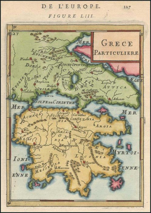
"Grece Particuliere". Full colour copper plate by MALLET, Allain Manesson, publ. in Paris 1683 in "Description de l'Univers". Map of the central Greece & Peloponnese. Map dim.11x14cm. Very Fine. Zach.2139.
Lot #8057 - various countries - maps
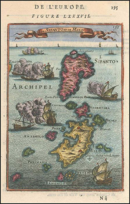
"I. de SIFANTO et de MILO". Full colour copper plate by MALLET, Allain Manesson, publ. in Paris 1683 in "Description de l'Univers". Attractive prospect of the islands of Milos & Serifos. Map dim. 11x14cm. Very Fine. Zach. 2150.
Lot #8058 - various countries - maps
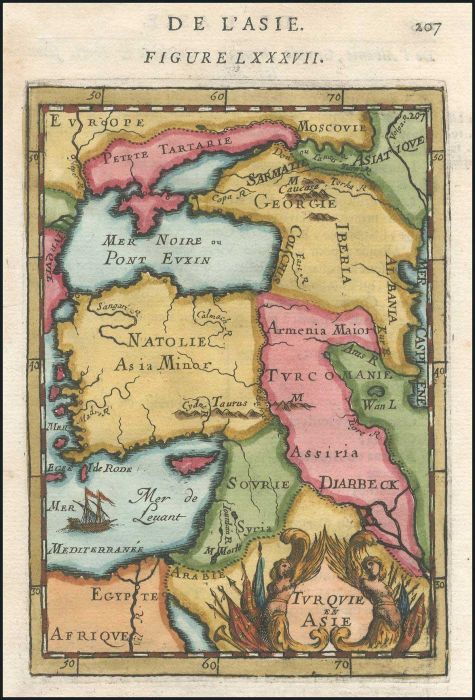
"Turquie en Asie" Full colour copper plate by MALLET, Allain Manesson, publ. in Paris 1683 in "Description de l'Univers". Map showing the extent of the Turkish Empire in Asia. Map dim.11x14cm. Very Fine.
Lot #8059 - various countries - maps
"I D'ANDRO et de TINE". Full colour copper plate by MALLET, Allain Manesson, publ. in Paris 1683 in "Description de l'Univers". Attractive prospect of Andros, Tinos, Delos & Rineia islands. Map dim. 11x14cm. Very Fine. Zach. 2145.
Lot #8060 - various countries - maps
"Grece Particuliere" hand coloured copper-engraving of Greece by Alain Manesson MALLET, 1686,1719 German ed. of "Description de l'Univers". Size: 15x11cm. Brown spots mainly on margins. Zacharakis 2139
Lot #8061 - various countries - maps
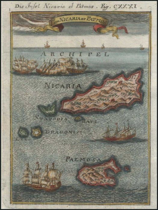
"Is. de Nicaria et Patmos" hand coloured copper-engraving of Ikaria & Patmos by Alain Manesson MALLET, 1686,1719 German ed. of "Description de l'Univers". Size: 15x11cm. Few light brown spots on margins. Zach.2135
Lot #8062 - various countries - maps
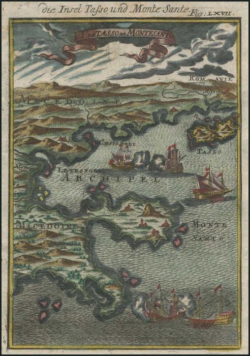
"Is. de Tasso et Montesanto" hand coloured copper-engraving of Chalkidiki, Mount Athos, Thasos & mainland by Alain Manesson MALLET, 1686,1719 German ed. of "Description de l'Univers". Size: 15x11cm. Narrow left margin, foxing. Zach.2142
Lot #8063 - various countries - maps
CORONELLI V. M. "Parte dell Isola di NIXIA" & "Battaglia data a' Turchi Sotto Nixia" on verso. 1688-1707. Two copper engr. in page with text. Map of Naxos and naval battle of F. MOROSINI in Naxos against the Turks. Engr. dim. 16x13cm. Sheet dim. 33x46.5cm
Lot #8064 - various countries - maps
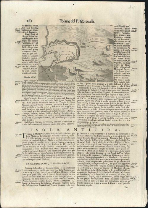
CORONELLI V. M. "Citta di RODI" 17th cent. Copper engr. map of the town of Rhodes (Aegean) & fortifications, in page with text. Map. dim. 17x13cm. Sheet dim. 33x46.5cm. Very Fine condition. Not in Zacharakis
Lot #8065 - various countries - maps
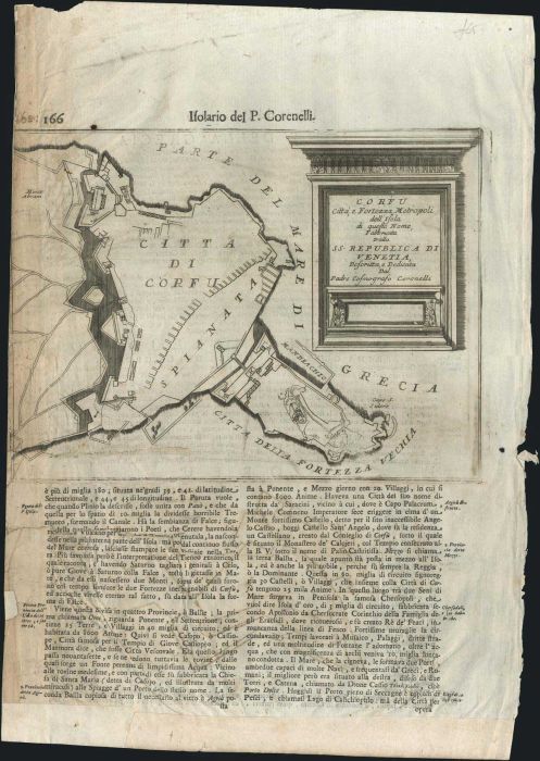
CORONELLI V. M. "CORFU Citta e Fortezza Metropoli..." & "Fortezza Nuiva di CORFU" on reverse, 17th cent. Two copper engr. very detailed plans of CORFU (Ionian) fortifications, in page with text. Map. dim. 29x22cm & 17x13cm, sheet dim.33x46.5cm. Chipped sh
Lot #8066 - various countries - maps
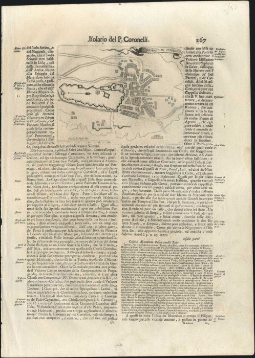
CORONELLI V. M. "S. GIORGIO di SCHIRO" 17th cent. Copper engr. map of the island of SKYROS (Aegean) & fortifications of the monastery of St. George, in page with text. Map. dim. 17x13cm. Sheet dim. 33x46.5cm. Very Fine condition. Not in Zacharakis
Lot #8067 - various countries - maps
CORONELLI V. M. "Fort di LEMNO" 17th cent. Copper engr. map of LEMNOS (Aegean) island fortifications, in page with text. Engr. of OTTOMAN cachets of Lemnos on reverse. Map. dim. 17x13cm. Sheet dim. 33x46.5cm. Small tear on left white margin, one brown spo
Lot #8068 - various countries - maps
CORONELLI V. M. "CARCHI e LIMONIA" 1688-1696. Copper engr. map of Halki & Alimia (Dodecanese) in page with text. Map. dim. 17x13cm. Sheet dim. 33x46.5cm. Two tears on left white margin, map in Very Fine condition. Zach.1129
Lot #8069 - various countries - maps
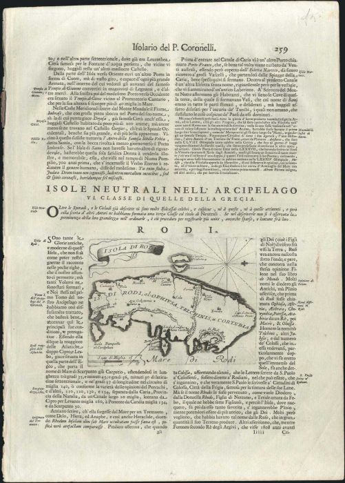
CORONELLI V. M. "Isola di RODI" 1688-1707. Copper engr. map of the island of Rhodes (Dodecanese) in page with text. Map. dim. 17x13cm. Sheet dim. 33x46.5cm. Very Fine condition. Zach.1137
Lot #8070 - various countries - maps
CORONELLI V. M. "FORT. DI CERIGO" & "PORTO DI CERIGO" 1687-1696 two copper engr. dim. 17x13cm on sheet dim. 34x47cm. of the port and fort of Cythera. Slight foxing. Zach.1079.
Lot #8071 - various countries - maps
CORONELLI V. M. "CEFALONIA", "ARGOSTOLI" & "FORTEZZA D'ASSO" 1687-1696 three copper engr. dim. 17x13cm on sheet dim. 34x47cm. Interesting views, not in Zacharakis. Slight foxing. Zach.1077 VAR.
Lot #8072 - various countries - maps
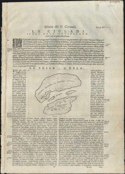
CORONELLI V. M. "Le Sdile o' DELO" 1690-1696, copper engr. map of Delos & Rineia islands from "Atlante Veneto-Isolario". In page with text & text on verso. Map dim. 16x13cm. Sheet dim. 33x46.5cm. Minor faults on sheet white margins, map in Very Fine condi
Lot #8073 - various countries - maps
CORONELLI V. M. "Isola di Piscopia nel mare di Rodi..." 1688-1707 copper engr. map of the island of Tilos. Map dim. 16.5x12.5cm, on part of sheet dim35x23cm. Very Fine, dark impression. Zach.1131
Lot #8074 - various countries - maps
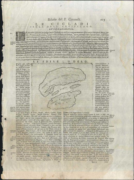
CORONELLI V. M. "Le Sdile o'Delo" from "Atlante Veneto-Isolario" 1690-1696 copper engr. dim. 17x13cm on sheet dim. 34x47cm. Map of Rineia & Delos islands. Tears along white margins, waterstain & some foxing. Zach.1124.
Lot #8075 - various countries - maps
CORONELLI V. M. "SIMIE", "PISCOPIA" & "Li NISARY" 1688,1695,1707, three copper engr. dim. 17x13cm on sheet dim. 34x47cm. Tear on left margin, folded corners, hole (1cm) in text & slight foxing. Zach.1130,1131,1132.
A. Karamitsos
A. Karamitsos are experienced auctioneers of Philatelic, Numismatic and Post Card. We are specialists in the stamps and postal history of Greece, Greek Errors, New Greek Territories, Levant,... Read More
Send Email to A. Karamitsos Or Visit WebSite


